


Red River Voting District, White County, Arkansas
About
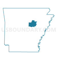
Outline

Summary
| Unique Area Identifier | 528453 |
| Name | Red River Voting District |
| County | White County |
| State | Arkansas |
| Area (square miles) | 26.42 |
| Land Area (square miles) | 26.22 |
| Water Area (square miles) | 0.19 |
| % of Land Area | 99.26 |
| % of Water Area | 0.74 |
| Latitude of the Internal Point | 35.18327950 |
| Longtitude of the Internal Point | -91.60792950 |
Maps


Graphs
Select a template below for downloading or customizing gragh for Red River Voting District, White County, Arkansas


Neighbors
Neighoring Voting District (by Name) Neighboring Voting District on the Map
- Dog Wood Voting District, White County, AR
- Francure Voting District, White County, AR
- Harrison East Voting District, White County, AR
- Kensett TWP Voting District, White County, AR
- Walker Voting District, White County, AR
- West Point City Voting District, White County, AR
Top 10 Neighboring County Subdivision (by Population) Neighboring County Subdivision on the Map
- Harrison township, White County, AR (6,325)
- Bald Knob township, White County, AR (4,193)
- Kensett township, White County, AR (2,183)
- Dogwood township, White County, AR (502)
- Red River township, White County, AR (452)
- Francure township, White County, AR (225)
- Walker township, White County, AR (183)